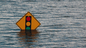
When a really bad storm hits, it causes chaos for both things and people. Once the storm is gone, one of the first things to do is check out the harm done to houses and businesses. This means understanding if your property is in a flood-prone area and how it affects your insurance costs.
The flood zone maps are made by FEMA, the Federal Emergency Management Agency. To create maps, they look at things like land features, rain patterns, and past floods. Insurance companies then use these maps to decide how much to charge for insurance.
Living in high-risk flood areas usually results in higher insurance rates due to the increased peril. However, even properties outside high-risk zones aren’t immune; FEMA reports that 20% of flood claims arise from properties beyond these zones.
So, what can you do to safeguard your home against flooding?
Unveiling Flood Zone Maps
FEMA employs flood zone maps to pinpoint flood-prone regions. These maps are split into three categories: Zone A, B, and C. Zone A carries the most significant flood risk, whereas Zone C presents the least.
Insurance providers refer to these maps to calculate flood insurance premiums. Properties in Zone A typically pay more than those in Zone B or C due to the heightened flood risk, leading to more claims in Zone A.
These maps might also help homebuyers make educated selections. If a property is in Zone A, buyers might reconsider due to the elevated flood risk.
These maps are essential for insurance firms and purchasers because they help identify flood-prone areas and determine premium prices.
Flood Zone Maps and Insurance Rates
In the US, insurance companies use flood zone maps to determine rates for high-risk properties. These maps, shaped by FEMA using past flood data, lead to higher premiums for high-risk regions. These areas typically experience higher insurance costs compared to low-risk zones.
Given that flood zone maps are dynamic, insurance companies must stay updated to calculate accurate rates. If your property lies in a high-risk area, you may need flood insurance, which isn’t usually part of standard homeowners’ policies, adding an extra cost.
If you’re thinking of buying a property in a flood zone, it’s crucial to talk to an agent about insurance. They can give you price estimates based on the latest flood zone map and help you grasp the coverage options.
Varieties of Flood Zone Maps
There are three main types of flood zone maps: FEMA’s National Flood Insurance Program (NFIP) maps, Flood Insurance Rate Maps (FIRMs), and Digital Flood Insurance Rate Maps (DFIRMs). The NFIP maps from FEMA are commonly used across the US to decide insurance costs and help homeowners grasp their flood vulnerability. FIRMs and DFIRMs also play a role in insurance pricing.
Navigating Flood Zone Maps
Flood zone maps resemble topographic maps, displaying flood-prone areas. Created by FEMA using National Flood Insurance Program (NFIP) data, they highlight various flood zones and the Base Flood Elevation (BFE) for each zone. BFE represents the projected water level during a 100-year flood, which is required for insurance calculations.
To interpret a flood zone map, locate your property and observe its zone, color-coded for risk – red for high-risk and green for low-risk. A black line represents the BFE.
In high-risk zones, obtaining flood insurance is advisable. Though not always required by lenders, it safeguards investments. As rates depend on the BFE, knowing your property’s BFE is crucial.
For queries about your flood zone or BFE, contact local FEMA offices or the NFIP.